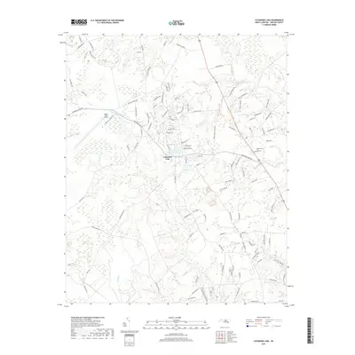
2019 Map of Catherine Lake
USGS Topo · Published 2019About this map
Lake Catherine and the settlement of Catherine Lake serve as the central hub of this coastal plain landscape in Onslow County. The terrain is defined by a complex network of slow-moving water, including the New River and its various tributaries such as Southwest Cr and Ninemile Cr. The presence of Morgan Bay and wide wetland areas like Deep Run suggest the seasonally saturated environment typical of the North Carolina tidewater region.
Find a feature on this map
112 named features on this map. Tap any name to fly to it.
Don’t see what you’re looking for? This feature index may not catch every label — zoom into the map to look around manually.
Map Details
Editions of this 2019 Catherine Lake Map
This is the sole edition of this map. No revisions or reprints were ever made.
Other maps of this area

1943 · Jacksonville
USGS Topo · 1:62,500

1948 · Maple Hill
USGS Topo · 1:62,500

1948 · New River
USGS Topo · 1:62,500

1948 · Richlands
USGS Topo · 1:62,500

1952 · Jacksonville South
USGS Topo · 1:24,000

1953 · Beaufort
USGS Topo · 1:250,000

1954 · Beaufort
USGS Topo · 1:250,000

1965 · Richlands
USGS Topo · 1:62,500

1972 · Beaufort
USGS Topo · 1:250,000
1975 · Jacksonville NW
USGS Topo · 1:24,000