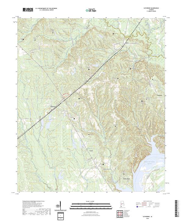
2024 Map of Catherine
USGS Topo · Published 2024About this map
Prairie Bluff stands as a significant historical anchor on this map, overlooking the William 'Bill' Dannelly Reservoir along the winding border of Wilcox and Dallas counties. This rural landscape is defined by its deep genealogical roots, evidenced by an exceptional density of family and community burial grounds including the Henry Young Family Cem, Rehoboth Cem, and the Shell Creek Cem. Small settlements like Catherine, Alberta, and Prairie are connected by a network of local routes such as Chitlin Switch Rd and Alberta School Rd. The terrain is shaped by numerous waterways, with Chilatchee Creek and Shell Creek cutting through the countryside. The presence of the Prairie Bluff Cem near the river suggests the long-standing occupation of these bluffs, offering a detailed map of the area's social and physical geography.
Find a feature on this map
60 named features on this map. Tap any name to fly to it.
Don’t see what you’re looking for? This feature index may not catch every label — zoom into the map to look around manually.
Map Details
Editions of this 2024 Catherine Map
This is the sole edition of this map. No revisions or reprints were ever made.
Other maps of this area

1953 · Montgomery
USGS Topo · 1:250,000

1956 · Montgomery
USGS Topo · 1:250,000

1957 · Montgomery
USGS Topo · 1:250,000

1968 · Thomaston East
USGS Topo · 1:24,000

1968 · Safford
USGS Topo · 1:24,000

1968 · Central Mills
USGS Topo · 1:24,000

1974 · Crumptonia
USGS Topo · 1:24,000

1974 · Catherine
USGS Topo · 1:24,000
1974 · Lee Long Bridge
USGS Topo · 1:24,000
1974 · Camden North
USGS Topo · 1:24,000