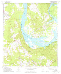
1974 Map of Camden North
USGS Topo · Published 1977About this map
The Alabama River dominates this mid-1970s landscape, featuring the wide expanse of the William "Bill" Dannelly Reservoir and its numerous access points like Cochran Landing and Ellis Ferry Access Point. The map provides a detailed view of the Gees Bend area, a region of significant cultural and agricultural importance, where scattered settlements like Boykin are surrounded by numerous family and community burial grounds, including Pettway Cem, Sodom Cem, and Pigeonfield Cem.
Find a feature on this map
47 named features on this map. Tap any name to fly to it.
Don’t see what you’re looking for? This feature index may not catch every label — zoom into the map to look around manually.
Map Details
Editions of this 1974 Camden North Map
This is the sole edition of this map. No revisions or reprints were ever made.
Other maps of this area

1953 · Montgomery
USGS Topo · 1:250,000

1953 · Andalusia
USGS Topo · 1:250,000

1956 · Montgomery
USGS Topo · 1:250,000

1957 · Montgomery
USGS Topo · 1:250,000

1957 · Andalusia
USGS Topo · 1:250,000

1957 · Carlowville
USGS Topo · 1:62,500

1973 · Coy
USGS Topo · 1:24,000

1973 · Camden South
USGS Topo · 1:24,000

1974 · Crumptonia
USGS Topo · 1:24,000

1974 · Catherine
USGS Topo · 1:24,000