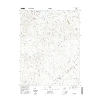
2016 Map of Catlett
USGS Topo · Published 2016About this map
New Baltimore and the surrounding Fauquier County countryside appear as a blend of established rural settlements and modern residential growth in this 2016 survey. The landscape is defined by its drainages, with Cedar Run and Kettle Run cutting through the terrain, while landmarks like Luntsfords Mtn and Baldwin Ridge provide topographical relief. The map documents numerous smaller locales and historic focal points, including the community of Casanova, the site of Balls Mill on Licking Run, and the village of Calverton.
Find a feature on this map
142 named features on this map. Tap any name to fly to it.
Don’t see what you’re looking for? This feature index may not catch every label — zoom into the map to look around manually.
Map Details
Editions of this 2016 Catlett Map
This is the sole edition of this map. No revisions or reprints were ever made.
Other maps of this area

1894 · Warrenton
USGS Topo · 1:125,000

1894 · Warrenton
USGS Topo · 1:62,500

1927 · Remington
USGS Topo · 1:48,000

1930 · Warrenton
USGS Topo · 1:62,500

1933 · Middleburg
USGS Topo · 1:62,500

1943 · Catlett
USGS Topo · 1:62,500

1943 · Thorofare Gap
USGS Topo · 1:24,000

1943 · Midland
USGS Topo · 1:24,000

1943 · Marshall
USGS Topo · 1:24,000
1944 · Midland
USGS Topo · 1:31,680