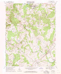
1966 Map of Catlett
USGS Topo · Published 1969About this map
Vint Hill Farms Station Military Reservation occupies a significant portion of the northern landscape, reflecting the military presence in rural Virginia during the mid-1960s. The region is defined by a network of drainage runs and established rail corridors, with the Southern railroad line cutting through the southeastern corner, anchoring the communities of Catlett and Calverton. Smaller settlements and crossroads like Greenwich and Auburn are connected by winding country roads, often centered around local landmarks such as Little Zion Ch or the Shale Pit.
Find a feature on this map
40 named features on this map. Tap any name to fly to it.
Don’t see what you’re looking for? This feature index may not catch every label — zoom into the map to look around manually.
Map Details
Editions of this 1966 Catlett Map
2 editions found
Other maps of this area

1894 · Warrenton
USGS Topo · 1:125,000

1894 · Warrenton
USGS Topo · 1:62,500

1927 · Remington
USGS Topo · 1:48,000

1930 · Warrenton
USGS Topo · 1:62,500

1933 · Middleburg
USGS Topo · 1:62,500

1943 · Catlett
USGS Topo · 1:62,500

1943 · Thorofare Gap
USGS Topo · 1:24,000

1943 · Midland
USGS Topo · 1:24,000

1943 · Marshall
USGS Topo · 1:24,000
1944 · Midland
USGS Topo · 1:31,680