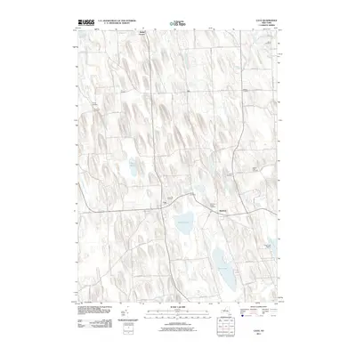
2011 Map of Cato
USGS Topo · Published 2011About this map
The village of Cato and the nearby village of Meridian anchor this portion of Cayuga County, defined by a distinct north-south glacial topography of elongated drumlins. This 2011 survey reveals a landscape where rural hamlets like Ira, Bethel Corners, and Benton Corners are connected by a network of local roads that navigate the narrow ridges and wetlands. The drainage patterns of Sterling Valley Creek and Muskrat Creek feed into significant water bodies such as Parker Pond, Otter Lake, and the northern reaches of Cross Lake. Genealogists will find a high concentration of burial sites throughout the townships, including the Meridian Village Cemetery, Union Hill Cemetery, and the White Cemetery on the northern edge. The area retains its agricultural character, evidenced by the dispersed nature of the settlements and the dominance of rural routes like Ira Station Rd and Town Line Rd.
Find a feature on this map
70 named features on this map. Tap any name to fly to it.
Don’t see what you’re looking for? This feature index may not catch every label — zoom into the map to look around manually.
Map Details
Editions of this 2011 Cato Map
This is the sole edition of this map. No revisions or reprints were ever made.
Other maps of this area

1900 · Baldwinsville
USGS Topo · 1:62,500

1900 · Oswego
USGS Topo · 1:62,500

1900 · Fulton
USGS Topo · 1:62,500

1902 · Weedsport
USGS Topo · 1:62,500

1943 · Jordan
USGS Topo · 1:31,680

1943 · Lysander
USGS Topo · 1:31,680

1943 · Montezuma
USGS Topo · 1:31,680

1943 · Cato
USGS Topo · 1:31,680

1943 · Hannibal
USGS Topo · 1:31,680

1943 · Weedsport
USGS Topo · 1:31,680