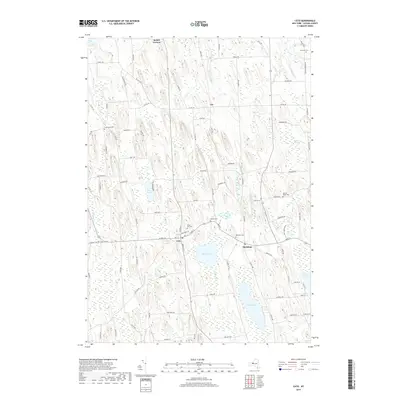
2019 Map of Cato
USGS Topo · Published 2019About this map
Cato and Meridian sit at the center of this Cayuga County landscape, where the drumlin-dominated topography of central New York dictates the settlement pattern. These elongated glacial hills separate a network of wetlands and water bodies, including Parker Pond and the extensive Beaver Meadows. The mapping detail captures a dense network of country roads such as Wise Rd and Watkins Rd that navigate the gaps between these steep landforms. Local genealogists will find significant value in the distribution of family and community burial grounds, from Union Hill Cem near the town center to the more isolated Marble Ridge Cem and Ferris Cem. To the east, Ninemile Cr and Muskrat Cr drain toward Cross Lake, highlighting the complex drainage system of the Finger Lakes region.
Find a feature on this map
94 named features on this map. Tap any name to fly to it.
Don’t see what you’re looking for? This feature index may not catch every label — zoom into the map to look around manually.
Map Details
Editions of this 2019 Cato Map
This is the sole edition of this map. No revisions or reprints were ever made.
Other maps of this area

1900 · Baldwinsville
USGS Topo · 1:62,500

1900 · Oswego
USGS Topo · 1:62,500

1900 · Fulton
USGS Topo · 1:62,500

1902 · Weedsport
USGS Topo · 1:62,500

1943 · Jordan
USGS Topo · 1:31,680

1943 · Lysander
USGS Topo · 1:31,680

1943 · Montezuma
USGS Topo · 1:31,680

1943 · Cato
USGS Topo · 1:31,680

1943 · Hannibal
USGS Topo · 1:31,680

1943 · Weedsport
USGS Topo · 1:31,680