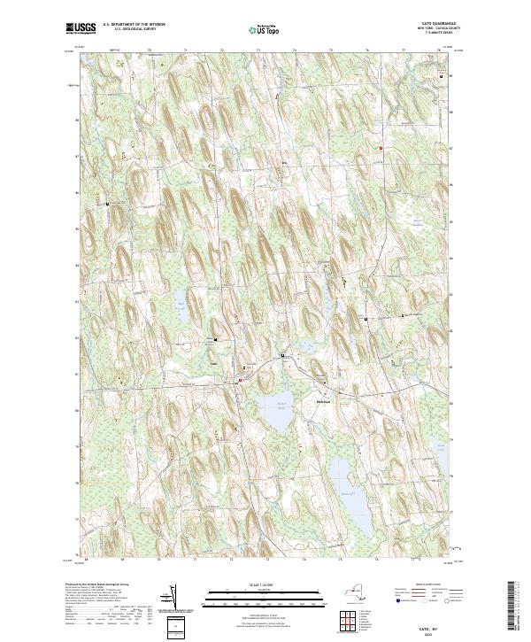
2023 Map of Cato
USGS Topo · Published 2023About this map
Cato and Meridian sit at the center of this landscape in western New York, where glacial drumlins create a distinct north-south rhythmic pattern in the terrain. These elongated hills dictate the drainage of local waterways like Sterling Valley Creek and Muskrat Creek, while forming the basins for Parker Pond and Otter Lake. The area's settlement history is etched into the landscape through its numerous burial grounds, including Ira Union Cem and Marble Ridge Cem, which serve as vital markers for genealogical research in Cayuga County.
Find a feature on this map
96 named features on this map. Tap any name to fly to it.
Don’t see what you’re looking for? This feature index may not catch every label — zoom into the map to look around manually.
Map Details
Editions of this 2023 Cato Map
This is the sole edition of this map. No revisions or reprints were ever made.
Other maps of this area

1900 · Baldwinsville
USGS Topo · 1:62,500

1900 · Oswego
USGS Topo · 1:62,500

1900 · Fulton
USGS Topo · 1:62,500

1902 · Weedsport
USGS Topo · 1:62,500

1943 · Jordan
USGS Topo · 1:31,680

1943 · Lysander
USGS Topo · 1:31,680

1943 · Montezuma
USGS Topo · 1:31,680

1943 · Cato
USGS Topo · 1:31,680

1943 · Hannibal
USGS Topo · 1:31,680

1943 · Weedsport
USGS Topo · 1:31,680