
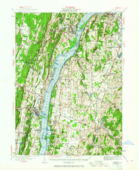
1934 Map of Catskill
USGS Topo · Published 1960About this map
The Hudson River serves as the central artery for this mid-1930s landscape, connecting riverfront settlements like Saugerties and Catskill. This era captures the transition of the valley from a strictly agrarian and industrial corridor into a cultural one, evidenced by the presence of Bard College and the landmark Birthplace of Robert Livingston. The interior of the Hudson Valley is densely populated with community markers, from the Katsbaan Ch and Bethel Ch to numerous numbered schoolhouses like School No 4 and School No 3 that served the rural townships of Clermont and Germantown. Industrial vestiges of the era are still prominent, including Red Hook Mills and Ham Mill, while the newly surveyed Rip Van Winkle Bridge spans the river at Rogers Island, signaling the growth of modern regional transportation.
Find a feature on this map
118 named features on this map. Tap any name to fly to it.
Don’t see what you’re looking for? This feature index may not catch every label — zoom into the map to look around manually.
Map Details
Editions of this 1934 Catskill Map
2 editions found
Other maps of this area

1892 · Kaaterskill
USGS Topo · 1:62,500

1893 · Kaaterskill
USGS Topo · 1:62,500

1893 · Coxsackie
USGS Topo · 1:62,500

1893 · Durham
USGS Topo · 1:62,500

1894 · Coxsackie
USGS Topo · 1:62,500

1894 · Kaaterskill
USGS Topo · 1:62,500

1894 · Durham
USGS Topo · 1:62,500

1895 · Catskill
USGS Topo · 1:62,500

1898 · Rhinebeck
USGS Topo · 1:62,500

1899 · Kaaterskill
USGS Topo · 1:62,500