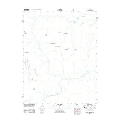
2012 Map of Cattle Mountain
USGS Topo · Published 2012About this map
The high Sierra Nevada landscape where the N Fork San Joaquin River meets the Middle Fork San Joaquin River is defined by its seasonal grazing and transit history. Named features like Seventyseven Corral and Bugg Cabin indicate the area's use as a rangeland, while the dense network of named clearings such as Naked Lady Meadow, Earthquake Meadow, and Indian Meadow suggest a reliance on specific pockets of navigable terrain. The San Joaquin River flows south from Miller Crossing, past landmarks like Junction Butte and Cattle Mountain. To the northeast, a chain of high-altitude water bodies including Gertrude Lake, Anona Lake, and Iron Lake sit beneath the shadows of Iron Mountain and the unique geological features of the Granite Stairway.
Find a feature on this map
45 named features on this map. Tap any name to fly to it.
Don’t see what you’re looking for? This feature index may not catch every label — zoom into the map to look around manually.
Map Details
Editions of this 2012 Cattle Mountain Map
This is the sole edition of this map. No revisions or reprints were ever made.
Other maps of this area

1901 · Mt. Lyell
USGS Topo · 1:125,000

1904 · Kaiser
USGS Topo · 1:125,000

1947 · Mariposa
USGS Topo · 1:250,000

1948 · Mariposa
USGS Topo · 1:250,000

1953 · Merced Peak
USGS Topo · 1:62,500

1953 · Devils Postpile
USGS Topo · 1:62,500

1953 · Shuteye Peak
USGS Topo · 1:62,500

1953 · Kaiser Peak
USGS Topo · 1:62,500

1957 · Mariposa
USGS Topo · 1:250,000

1963 · Mariposa
USGS Topo · 1:250,000