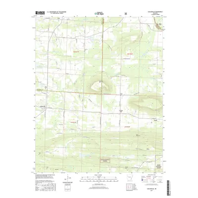
2017 Map of Caulksville
USGS Topo · Published 2017About this map
Horseshoe Mtn and the southern reaches of the Ozark National Forest define the topography of this Logan and Franklin County landscape. The area transitions from the higher elevations of Pine Ridge Mtn and Brushy Mtn down into the Arkansas River valley, where small communities like Caulksville and Carbon City are established. This 2017 survey reveals a rural infrastructure built around local water sources such as Sixmile Creek and Short Mountain Cr, with numerous small lakes dotting the northern section including Lake Number Sixteen and Lake Number Seventeen.
Find a feature on this map
81 named features on this map. Tap any name to fly to it.
Don’t see what you’re looking for? This feature index may not catch every label — zoom into the map to look around manually.
Map Details
Editions of this 2017 Caulksville Map
This is the sole edition of this map. No revisions or reprints were ever made.
Other maps of this area

1879 · Mountain Home
USGS Topo · 1:62,500

1887 · Magazine Mountain #1
USGS Topo · 1:62,500

1887 · Magazine Mountain #4
USGS Topo · 1:62,500

1887 · Magazine Mountain #2
USGS Topo · 1:62,500

1887 · Magazine Mountain #3
USGS Topo · 1:62,500

1887 · Magazine Mountain
USGS Topo · 1:62,500

1890 · Magazine Mountain
USGS Topo · 1:125,000

1934 · Booneville
USGS Topo · 1:48,000

1939 · Booneville
USGS Topo · 1:62,500

1956 · Russellville
USGS Topo · 1:250,000