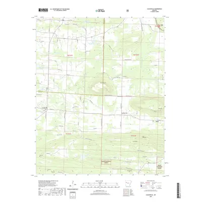
2020 Map of Caulksville
USGS Topo · Published 2020About this map
Paris and Caulksville anchor the corners of this Logan County landscape, where the northern edge of the Ozark National Forest meets the valley of Sixmile Creek. The terrain is defined by prominent elevations such as Horseshoe Mountain and Short Mountain, which rise sharply from the surrounding creek bottoms and small-scale agricultural plots. A network of local routes like Shaver Rd and Corley Rd connects the rural settlements of Carbon City and Etna, reflecting a long-standing pattern of dispersed hill-country habitation. Genealogists will find several notable burial sites documented, including Saint Anthony Cemetery and McVay Cemetery. The presence of the Etna Airport and numbered water bodies like Lake Number Sixteen highlight the modern utility of this area, while Dry Fork and Hurricane Creek trace the natural drainage of the Arkansas River valley foothills.
Find a feature on this map
85 named features on this map. Tap any name to fly to it.
Don’t see what you’re looking for? This feature index may not catch every label — zoom into the map to look around manually.
Map Details
Editions of this 2020 Caulksville Map
This is the sole edition of this map. No revisions or reprints were ever made.
Other maps of this area

1879 · Mountain Home
USGS Topo · 1:62,500

1887 · Magazine Mountain #1
USGS Topo · 1:62,500

1887 · Magazine Mountain #4
USGS Topo · 1:62,500

1887 · Magazine Mountain #2
USGS Topo · 1:62,500

1887 · Magazine Mountain #3
USGS Topo · 1:62,500

1887 · Magazine Mountain
USGS Topo · 1:62,500

1890 · Magazine Mountain
USGS Topo · 1:125,000

1934 · Booneville
USGS Topo · 1:48,000

1939 · Booneville
USGS Topo · 1:62,500

1956 · Russellville
USGS Topo · 1:250,000