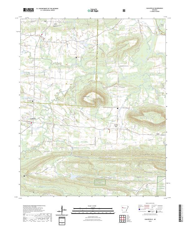
2024 Map of Caulksville
USGS Topo · Published 2024About this map
The Franklin Co Logan Co boundary bisects this western Arkansas landscape, where the valley of Sixmile Creek serves as a corridor between the high ridges of the Ozark National Forest and the peaks of Short Mtn and Horseshoe Mtn. Settlements are clustered along the major east-west arteries, with Caulksville and Carbon City anchoring the transition from open farmland to the more developed edge of Paris. The map reveals a highly structured rural environment, characterized by a dense network of numbered county roads and private lanes like Garth Brooks Ln and O Kane Park Rd.
Find a feature on this map
87 named features on this map. Tap any name to fly to it.
Don’t see what you’re looking for? This feature index may not catch every label — zoom into the map to look around manually.
Map Details
Editions of this 2024 Caulksville Map
This is the sole edition of this map. No revisions or reprints were ever made.
Other maps of this area

1879 · Mountain Home
USGS Topo · 1:62,500

1887 · Magazine Mountain #1
USGS Topo · 1:62,500

1887 · Magazine Mountain #4
USGS Topo · 1:62,500

1887 · Magazine Mountain #2
USGS Topo · 1:62,500

1887 · Magazine Mountain #3
USGS Topo · 1:62,500

1887 · Magazine Mountain
USGS Topo · 1:62,500

1890 · Magazine Mountain
USGS Topo · 1:125,000

1934 · Booneville
USGS Topo · 1:48,000

1939 · Booneville
USGS Topo · 1:62,500

1956 · Russellville
USGS Topo · 1:250,000