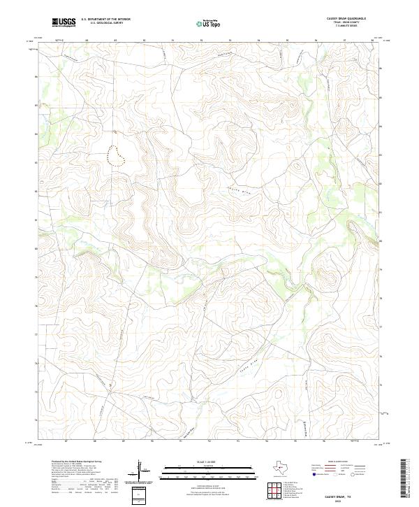
2022 Map of Causey Draw
USGS Topo · Published 2022About this map
The Middle Concho River winds through this West Texas landscape, defining a geography of seasonal drainages and ranch access roads. This high-plateau region of Irion County is characterized by significant topographic features such as Causey Draw and Tepee Draw, which serve as primary conduits for runoff during the region's infrequent but heavy rains. The network of local roads, including Momma Pfluger Rd and Bacon Rind Rd, reveals a modern pastoral land use pattern where large acreage is managed via named tracks like Lewis Trap Rd and Salthouse Rd. The inclusion of Kiowa Cr in the northeast corner and Antelope Draw to the south underscores the area's reliance on these natural watercourses for orientation and livestock management in a semi-arid environment.
Find a feature on this map
14 named features on this map. Tap any name to fly to it.
Don’t see what you’re looking for? This feature index may not catch every label — zoom into the map to look around manually.
Map Details
Editions of this 2022 Causey Draw Map
This is the sole edition of this map. No revisions or reprints were ever made.
Other maps of this area

1921 · Ketchum Mountain
USGS Topo · 1:62,500

1923 · Ketchum Mountain
USGS Topo · 1:62,500

1954 · San Angelo
USGS Topo · 1:250,000

1958 · San Angelo
USGS Topo · 1:250,000

1965 · San Angelo
USGS Topo · 1:250,000

1970 · South Mustang Draw SE
USGS Topo · 1:24,000

1970 · South Mustang Draw NE
USGS Topo · 1:24,000

1973 · Hay Hollow
USGS Topo · 1:24,000
1973 · Bradford Draw
USGS Topo · 1:24,000

1973 · Three Bluff Draw
USGS Topo · 1:24,000