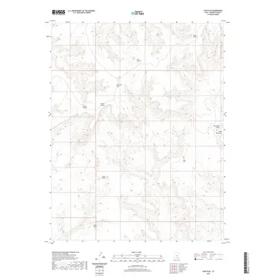
2020 Map of Cave Flat
USGS Topo · Published 2020About this map
Tarantula Mesa and Swap Mesa dominate this high-desert landscape in Garfield County, showcasing the distinctive geological benching and drainage patterns of the Henry Mountains region. The terrain is defined by a complex network of deep erosional features, including Seven Canyon, Five Canyon, and Swap Canyon, which channel intermittent water toward the lower reaches. This modern survey illustrates the natural topography before any significant modern development, emphasizing the isolated character of Cave Flat. Hydrographic details such as Muley Cr and Bullfrog Cr reveal the primary drainage systems that have carved these canyons over time. The map also identifies Pipe Spring Canyon and Divide Canyon, providing essential landmarks for understanding the area's physical geography and historical access points within the public land survey system.
Find a feature on this map
12 named features on this map. Tap any name to fly to it.
Don’t see what you’re looking for? This feature index may not catch every label — zoom into the map to look around manually.
Map Details
Editions of this 2020 Cave Flat Map
This is the sole edition of this map. No revisions or reprints were ever made.
Other maps of this area

1885 · San Rafael
USGS Topo · 1:250,000

1885 · Fish Lake
USGS Topo · 1:250,000

1886 · Escalante
USGS Topo · 1:250,000

1886 · Henry Mountains
USGS Topo · 1:250,000

1892 · Henry Mountains
USGS Topo · 1:250,000

1896 · Fish Lake
USGS Topo · 1:250,000

1952 · Notom 4 SE
USGS Topo · 1:24,000

1952 · Mt Pennell 2 NE
USGS Topo · 1:24,000

1952 · Notom
USGS Topo · 1:62,500

1953 · Mt Pennell
USGS Topo · 1:62,500