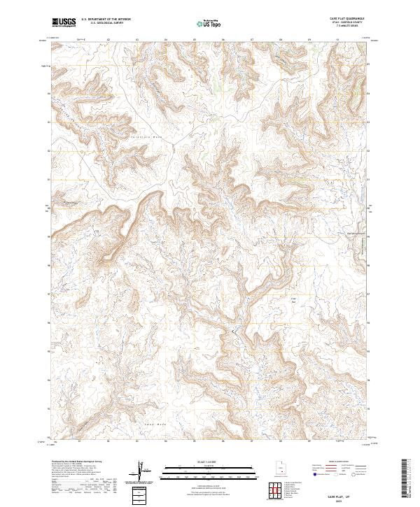
2023 Map of Cave Flat
USGS Topo · Published 2023About this map
The high plateau country of Tarantula Mesa and Swap Mesa dominates this landscape in southern Garfield County, where deep incisions from intermittent watercourses define the geology. The drainage network is particularly dense here, with Muley Creek carving a complex path through the center of the sheet, while the western edge is marked by the steep walls of Spring Canyon. To the east, the terrain rises toward the western flanks of the Henry Mountains, providing a dramatic transition from the flat-topped mesas to the high peaks.
Find a feature on this map
12 named features on this map. Tap any name to fly to it.
Don’t see what you’re looking for? This feature index may not catch every label — zoom into the map to look around manually.
Map Details
Editions of this 2023 Cave Flat Map
This is the sole edition of this map. No revisions or reprints were ever made.
Other maps of this area

1885 · San Rafael
USGS Topo · 1:250,000

1885 · Fish Lake
USGS Topo · 1:250,000

1886 · Escalante
USGS Topo · 1:250,000

1886 · Henry Mountains
USGS Topo · 1:250,000

1892 · Henry Mountains
USGS Topo · 1:250,000

1896 · Fish Lake
USGS Topo · 1:250,000

1952 · Notom 4 SE
USGS Topo · 1:24,000

1952 · Mt Pennell 2 NE
USGS Topo · 1:24,000

1952 · Notom
USGS Topo · 1:62,500

1953 · Mt Pennell
USGS Topo · 1:62,500