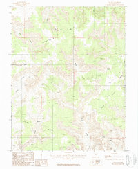
1987 Map of Cave Flat
USGS Topo · Published 1987About this map
Tarantula Mesa and the expansive reach of Cave Flat dominate this 1980s landscape in Garfield County, Utah. The terrain is defined by a complex network of canyons and high plateaus, where water sources like Swap Canyon Springs and the Cave Flat Reservoir are essential markers in the arid environment. A transition in elevation is noted at Sandy Creek Divide, which separates the drainages of Sandy Creek from the southern reaches of the quadrangle. The map captures a moment of remote land use characterized by seasonal water management and the natural boundaries of Swap Mesa and Muley Creek. These features illustrate the geological isolation of the region before more modern infrastructure reached this part of the Colorado Plateau, preserving the ranching and surveying history of the canyonlands.
Find a feature on this map
15 named features on this map. Tap any name to fly to it.
Don’t see what you’re looking for? This feature index may not catch every label — zoom into the map to look around manually.
Map Details
Editions of this 1987 Cave Flat Map
This is the sole edition of this map. No revisions or reprints were ever made.
Other maps of this area

1885 · San Rafael
USGS Topo · 1:250,000

1885 · Fish Lake
USGS Topo · 1:250,000

1886 · Escalante
USGS Topo · 1:250,000

1886 · Henry Mountains
USGS Topo · 1:250,000

1892 · Henry Mountains
USGS Topo · 1:250,000

1896 · Fish Lake
USGS Topo · 1:250,000

1952 · Notom 4 SE
USGS Topo · 1:24,000

1952 · Mt Pennell 2 NE
USGS Topo · 1:24,000

1952 · Notom
USGS Topo · 1:62,500

1953 · Mt Pennell
USGS Topo · 1:62,500