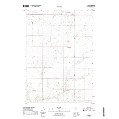
2017 Map of Cavour
USGS Topo · Published 2017About this map
Cavour sits at the northern edge of this Beadle County landscape, serving as a primary point of settlement along the east-west highway corridor. The surrounding terrain is defined by an intricate network of wetlands and small basins, characteristic of the glaciated prairie. Drainage across the southern portion of the sheet is dominated by the winding course of Pearl Creek, which is joined by Middle Pearl Cr as it meanders through the township boundaries. This 2017 survey illustrates the enduring section-line road grid, where routes like Co Rd 22 and Co Rd 26 partition the agricultural lands between the drainage of Pearl Cr and the numerous small, seasonal water bodies that dot the northern sections.
Find a feature on this map
20 named features on this map. Tap any name to fly to it.
Don’t see what you’re looking for? This feature index may not catch every label — zoom into the map to look around manually.
Map Details
Editions of this 2017 Cavour Map
This is the sole edition of this map. No revisions or reprints were ever made.
Other maps of this area

1898 · Huron
USGS Topo · 1:125,000

1899 · De Smet
USGS Topo · 1:125,000

1953 · Huron
USGS Topo · 1:250,000

1953 · Watertown
USGS Topo · 1:250,000

1954 · Huron
USGS Topo · 1:250,000

1957 · Forestburg NE
USGS Topo · 1:24,000

1957 · Cavour
USGS Topo · 1:24,000

1957 · Huron
USGS Topo · 1:24,000

1958 · Watertown
USGS Topo · 1:250,000

1958 · Forestburg NW
USGS Topo · 1:24,000