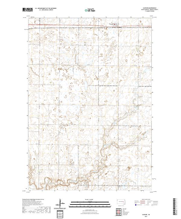
2021 Map of Cavour
USGS Topo · Published 2021About this map
The settlement of Cavour sits in the northeastern corner of this Beadle County landscape, serving as a primary point of reference for the surrounding prairie. This area is characterized by a complex drainage system defined by the wandering paths of Pearl Cr and Middle Pearl Cr. The hydrology here is notably fragmented, with numerous small, unnamed basins and seasonal wetlands dotting the townships. A rigid grid of section-line roads, including Co RD 22 and 209th ST, organizes the agricultural interior and demonstrates the systematic land division of the region. The map captures the quiet, rural character of the eastern South Dakota plains, where the subtle elevation changes dictate the flow of Pearl Creek toward the south.
Find a feature on this map
20 named features on this map. Tap any name to fly to it.
Don’t see what you’re looking for? This feature index may not catch every label — zoom into the map to look around manually.
Map Details
Editions of this 2021 Cavour Map
This is the sole edition of this map. No revisions or reprints were ever made.
Other maps of this area

1898 · Huron
USGS Topo · 1:125,000

1899 · De Smet
USGS Topo · 1:125,000

1953 · Huron
USGS Topo · 1:250,000

1953 · Watertown
USGS Topo · 1:250,000

1954 · Huron
USGS Topo · 1:250,000

1957 · Forestburg NE
USGS Topo · 1:24,000

1957 · Cavour
USGS Topo · 1:24,000

1957 · Huron
USGS Topo · 1:24,000

1958 · Watertown
USGS Topo · 1:250,000

1958 · Forestburg NW
USGS Topo · 1:24,000