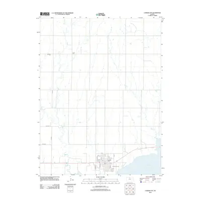
2012 Map of Cawker City
USGS Topo · Published 2012About this map
Cawker City occupies a prominent position on the northern shore of Waconda Lake in this 2012 survey. The town plan is defined by a grid of numbered streets and named thoroughfares like Walnut St and Redwood St, serving as a central hub for the surrounding agricultural landscape. Notable local landmarks include the world-famous Ball of Twine and the local Po, while the southern edge of town transitions into the Lakeside Golf Course along the water's edge. Beyond the city limits, the terrain is etched by several drainage systems, including Little Oak Cr, Oak Cr, and Granite Cr, which flow toward the reservoir. For those researching family history, the map identifies rural burial sites such as Rooker Cem and Reformed Cem, situated amidst the section-line roads and open fields that characterize this portion of Mitchell County.
Find a feature on this map
30 named features on this map. Tap any name to fly to it.
Don’t see what you’re looking for? This feature index may not catch every label — zoom into the map to look around manually.
Map Details
Editions of this 2012 Cawker City Map
This is the sole edition of this map. No revisions or reprints were ever made.
Other maps of this area

1893 · Smith Center
USGS Topo · 1:125,000

1894 · Mankato
USGS Topo · 1:125,000

1894 · Beloit
USGS Topo · 1:125,000

1896 · Osborne
USGS Topo · 1:125,000

1953 · Downs South
USGS Topo · 1:24,000

1953 · Waconda Springs
USGS Topo · 1:24,000

1953 · Glen Elder South
USGS Topo · 1:24,000

1955 · Beloit
USGS Topo · 1:250,000

1959 · Beloit
USGS Topo · 1:250,000

1960 · Downs North
USGS Topo · 1:24,000