
1953 Map of Waconda Springs
USGS Topo · Published 1954About this map
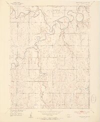
Waconda Springs and the nearby Great Spirit Spring define the northern landscape of this Mitchell County quadrangle, captured shortly before the construction of the Glen Elder Dam forever altered this river valley. The confluence of the North Fork Solomon River and the South Fork Solomon River creates a meandering waterway that snakes through the townships of Cawker and Carr Creek. This 1950s survey preserves the original terrestrial footprints of rural life, from the Town Hall in Carr Creek to the Plainview Ch in the southern hills.
Find a feature on this map
20 named features on this map. Tap any name to fly to it.
Don’t see what you’re looking for? This feature index may not catch every label — zoom into the map to look around manually.
Map Details
Editions of this 1953 Waconda Springs Map
4 editions found
Other maps of this area

1893 · Smith Center
USGS Topo · 1:125,000

1894 · Mankato
USGS Topo · 1:125,000

1894 · Beloit
USGS Topo · 1:125,000

1896 · Osborne
USGS Topo · 1:125,000

1953 · Downs South
USGS Topo · 1:24,000

1953 · Glen Elder South
USGS Topo · 1:24,000

1955 · Beloit
USGS Topo · 1:250,000

1959 · Beloit
USGS Topo · 1:250,000

1960 · Downs North
USGS Topo · 1:24,000

1962 · Cawker City
USGS Topo · 1:24,000