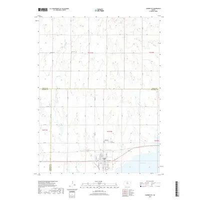
2018 Map of Cawker City
USGS Topo · Published 2018About this map
Cawker City sits at the northern edge of Waconda Lake in this 2018 survey, where the town’s grid meets the expansive shoreline. The landscape is defined by the drainage of several local waterways including Little Oak Creek, Granite Creek, and Oak Creek, which feed into the reservoir from the north and west. This contemporary map documents the community’s layout, showing local streets from Willow St to Holly St and S 1st Ave. For genealogists and local historians, several rural burial grounds are meticulously noted outside the city limits, including the Saints Peter and Paul Cem and Prairie Grove Cem situated just to the north, as well as the more distant Rooker Cemetery and Reformed Cemetery. The map also clearly delineates the tri-county junction of Jewell, Osborne, and Mitchell counties.
Find a feature on this map
61 named features on this map. Tap any name to fly to it.
Don’t see what you’re looking for? This feature index may not catch every label — zoom into the map to look around manually.
Map Details
Editions of this 2018 Cawker City Map
This is the sole edition of this map. No revisions or reprints were ever made.
Other maps of this area

1893 · Smith Center
USGS Topo · 1:125,000

1894 · Mankato
USGS Topo · 1:125,000

1894 · Beloit
USGS Topo · 1:125,000

1896 · Osborne
USGS Topo · 1:125,000

1953 · Downs South
USGS Topo · 1:24,000

1953 · Waconda Springs
USGS Topo · 1:24,000

1953 · Glen Elder South
USGS Topo · 1:24,000

1955 · Beloit
USGS Topo · 1:250,000

1959 · Beloit
USGS Topo · 1:250,000

1960 · Downs North
USGS Topo · 1:24,000