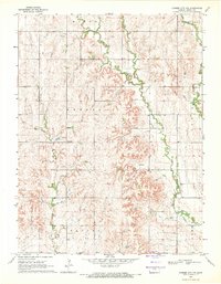
1969 Map of Cawker City NW
USGS Topo · Published 1971About this map
Dentonia serves as a central landmark in this 1960s study of Jewell County, Kansas, where the landscape is defined by the intricate dendritic drainage patterns of the Limestone Creek system. The map captures a primarily agricultural region organized into civil townships including Esbon, Odessa, and Ionia. Water management and natural topography are evident through the paths of Porcupine Creek and West Limestone Creek, which carve deep, branching valleys into the upland plains. Evidence of early community infrastructure is preserved through the locations of Odessa Ch and Mt Carmel Cem. Several quarry sites are noted across the terrain, indicating local resource extraction amid the section-line roads that dominate the rural grid.
Find a feature on this map
15 named features on this map. Tap any name to fly to it.
Don’t see what you’re looking for? This feature index may not catch every label — zoom into the map to look around manually.
Map Details
Editions of this 1969 Cawker City NW Map
This is the sole edition of this map. No revisions or reprints were ever made.
Other maps of this area

1893 · Smith Center
USGS Topo · 1:125,000

1894 · Mankato
USGS Topo · 1:125,000

1955 · Beloit
USGS Topo · 1:250,000

1959 · Beloit
USGS Topo · 1:250,000

1960 · Downs North
USGS Topo · 1:24,000

1962 · Cawker City
USGS Topo · 1:24,000

1962 · Glen Elder North
USGS Topo · 1:24,000

1968 · Burr Oak
USGS Topo · 1:24,000
1969 · Ionia
USGS Topo · 1:24,000
1969 · Esbon
USGS Topo · 1:24,000