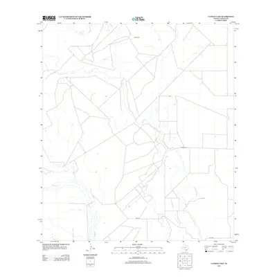
2012 Map of Cayman Lake
USGS Topo · Published 2012About this map
The Frio River defines this portion of La Salle County, carving a winding path through a landscape of expansive ranchlands and seasonal waterways. Large private holdings such as Sharp Ranch and Hindes Ranch characterize the settlement pattern of the early twenty-first century, reflecting the enduring cattle and land-use traditions of South Texas. The hydrological network is quite intricate, featuring the namesake Cayman Lake and the meandering Cayman Slough, alongside several named tributaries including Ruiz Cr, Cibolo Cr, and Nogate Cr. Transportation across this rural expanse is limited to a network of local tracks and the prominent Natus Rd in the southern portion of the quadrangle.
Find a feature on this map
9 named features on this map. Tap any name to fly to it.
Don’t see what you’re looking for? This feature index may not catch every label — zoom into the map to look around manually.
Map Details
Editions of this 2012 Cayman Lake Map
This is the sole edition of this map. No revisions or reprints were ever made.
Other maps of this area

1929 · Cotulla
USGS Topo · 1:125,000

1940 · Cotulla
USGS Topo · 1:62,500

1942 · Fowlerton
USGS Topo · 1:62,500

1942 · Dilley
USGS Topo · 1:62,500

1953 · Crystal City
USGS Topo · 1:250,000

1955 · Crystal City
USGS Topo · 1:250,000

1956 · Hindes
USGS Topo · 1:62,500

1956 · Fowlerton
USGS Topo · 1:62,500

1961 · Crystal City
USGS Topo · 1:250,000

1968 · Crystal City
USGS Topo · 1:250,000