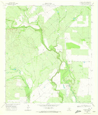
1969 Map of Cayman Lake
USGS Topo · Published 1972About this map
The Frio River snakes through this South Texas landscape, defining a riparian corridor where the waters of Cayman Lake and the winding Cayman Slough meet the surrounding brush country. Surveyed in the late 1960s, the map reveals a region defined by large ranching tracts and water management, with named holdings like Sharp Ranch and Hindes Ranch serving as primary local landmarks. The modest settlement at Angeles and scattered Well sites underscore the importance of water infrastructure in this arid environment.
Find a feature on this map
13 named features on this map. Tap any name to fly to it.
Don’t see what you’re looking for? This feature index may not catch every label — zoom into the map to look around manually.
Map Details
Editions of this 1969 Cayman Lake Map
This is the sole edition of this map. No revisions or reprints were ever made.
Other maps of this area

1929 · Cotulla
USGS Topo · 1:125,000

1940 · Cotulla
USGS Topo · 1:62,500

1942 · Fowlerton
USGS Topo · 1:62,500

1942 · Dilley
USGS Topo · 1:62,500

1953 · Crystal City
USGS Topo · 1:250,000

1955 · Crystal City
USGS Topo · 1:250,000

1956 · Hindes
USGS Topo · 1:62,500

1956 · Fowlerton
USGS Topo · 1:62,500

1961 · Crystal City
USGS Topo · 1:250,000

1968 · Crystal City
USGS Topo · 1:250,000