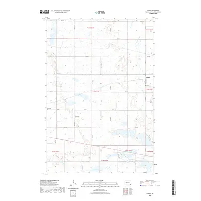
2020 Map of Cayuga
USGS Topo · Published 2020About this map
Cayuga serves as the central hub of this prairie landscape in Sargent County, situated at the intersection of Co Rd 12 and Co Rd 3. The terrain is defined by the winding course of the Wild Rice River, which flows through the eastern portion of the map, and the scattered wetlands typical of the region, including Clouds Lake and Crooked Cr. Local heritage is anchored by several burial grounds, specifically Cayuga Community Cem, Rutland Cem, and Nordland Cem, which reflect the historical settlement patterns of the surrounding townships. The grid of section lines and gravel roads, such as 89th St SE and 141st Ave SE, illustrates the enduring structure of North Dakota’s agricultural landscape into the twenty-first century.
Find a feature on this map
33 named features on this map. Tap any name to fly to it.
Don’t see what you’re looking for? This feature index may not catch every label — zoom into the map to look around manually.
Map Details
Editions of this 2020 Cayuga Map
This is the sole edition of this map. No revisions or reprints were ever made.
Other maps of this area

1907 · Wyndmere
USGS Topo · 1:125,000

1953 · Milbank
USGS Topo · 1:250,000

1953 · Fargo
USGS Topo · 1:250,000

1956 · Fargo
USGS Topo · 1:250,000

1956 · Havana
USGS Topo · 1:24,000

1958 · Milbank
USGS Topo · 1:250,000

1958 · Marlow
USGS Topo · 1:24,000

1958 · Rutland
USGS Topo · 1:24,000

1958 · Veblen NE
USGS Topo · 1:24,000

1958 · Cayuga NW
USGS Topo · 1:24,000