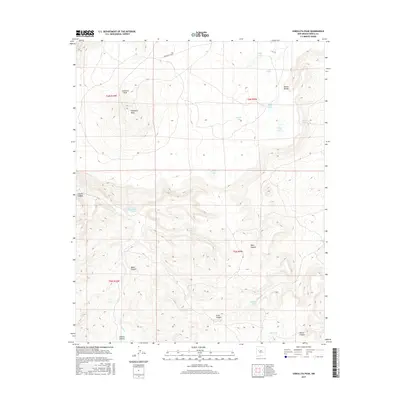
2017 Map of Cebollita Peak
USGS Topo · Published 2017About this map
Cebollita Peak and the high expanse of Cebollita Mesa dominate this high-desert landscape in New Mexico's Cibola County. The terrain is defined by a network of deep drainages including Cebolla Canyon, Baker Canyon, and Brazo Canyon, which reveal the complex topography of this region. Surface water is represented by a series of scattered catchments and natural pools such as Rodeo Lake, Middle Lake, and Flag Lake, alongside vital water sources like Cebolla Spring and Major Spring.
Find a feature on this map
26 named features on this map. Tap any name to fly to it.
Don’t see what you’re looking for? This feature index may not catch every label — zoom into the map to look around manually.
Map Details
Editions of this 2017 Cebollita Peak Map
This is the sole edition of this map. No revisions or reprints were ever made.
Other maps of this area
1917 · Broom Mountain
USGS Topo · 1:125,000
1954 · Socorro
USGS Topo · 1:250,000
1958 · Socorro
USGS Topo · 1:250,000
1961 · North Pasture
USGS Topo · 1:24,000
1961 · Blue Mesa
USGS Topo · 1:24,000
1961 · Laguna Honda
USGS Topo · 1:24,000
1962 · Socorro
USGS Topo · 1:250,000
1964 · Sand Canyon
USGS Topo · 1:24,000
1964 · Cebollita Peak
USGS Topo · 1:24,000
1964 · Wiley Mesa
USGS Topo · 1:24,000