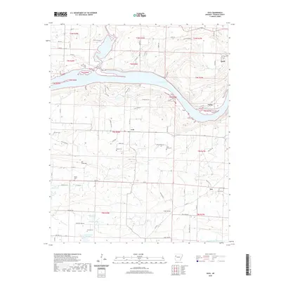
2020 Map of Cecil
USGS Topo · Published 2020About this map
Ozark Lake dominates the northern landscape of this Franklin County survey, where the Arkansas River valley is defined by dramatic elevation changes. The settlement of Cecil serves as a central point for the region's rural road network, including State Hwy 41 and several routes leading toward the water, such as the Citadel Bluff Trl. For genealogists and local historians, this map is particularly dense with burial sites, capturing the locations of Oak Grove Cem, Price Springs Cem, Browns Chapel Cem, and Patterson Cem. These sites, along with smaller locales like Meg and Poping, reflect the long-standing community structure of the Ozark foothills. Significant natural landmarks like Citadel Bluff and Mill Creek Mtn provide context for the distribution of these early homesteads and cemeteries tucked into the hollows and ridge lines.
Find a feature on this map
82 named features on this map. Tap any name to fly to it.
Don’t see what you’re looking for? This feature index may not catch every label — zoom into the map to look around manually.
Map Details
Editions of this 2020 Cecil Map
This is the sole edition of this map. No revisions or reprints were ever made.
Other maps of this area

1879 · Cravens
USGS Topo · 1:62,500

1887 · Magazine Mountain #2
USGS Topo · 1:62,500

1887 · Watalula
USGS Topo · 1:62,500

1887 · Magazine Mountain
USGS Topo · 1:62,500

1890 · Magazine Mountain
USGS Topo · 1:125,000

1890 · Fort Smith
USGS Topo · 1:125,000

1898 · Winslow #4
USGS Topo · 1:62,500

1898 · Winslow
USGS Topo · 1:125,000

1901 · Winslow
USGS Topo · 1:125,000

1906 · Lavaca
USGS Topo · 1:62,500