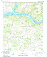
1993 Map of Cecil
USGS Topo · Published 1993About this map
Ozark Lake and the winding Arkansas River dominate this Franklin County landscape, where the waters are overlooked by the prominent Citadel Bluff. The settlement of Cecil serves as a local hub, situated near a network of rural roads and utility infrastructure, including a prominent Pipeline corridor. The area's topography is defined by the significant rise of Mill Creek Mountain, which separates the river valley from the southern drainages of Mill Creek and Hurricane Creek. Numerous small cemeteries and community landmarks are scattered throughout the hills, providing a clear record of local settlement patterns. Genealogists may find value in the specific locations of the Berkley Cem, Price Springs Cem, and Patterson Cem, while smaller settlements like Meg and Poping indicate the dispersed nature of these upland Arkansas communities during the late twentieth century.
Find a feature on this map
36 named features on this map. Tap any name to fly to it.
Don’t see what you’re looking for? This feature index may not catch every label — zoom into the map to look around manually.
Map Details
Editions of this 1993 Cecil Map
This is the sole edition of this map. No revisions or reprints were ever made.
Other maps of this area

1879 · Cravens
USGS Topo · 1:62,500

1887 · Magazine Mountain #2
USGS Topo · 1:62,500

1887 · Watalula
USGS Topo · 1:62,500

1887 · Magazine Mountain
USGS Topo · 1:62,500

1890 · Magazine Mountain
USGS Topo · 1:125,000

1890 · Fort Smith
USGS Topo · 1:125,000

1898 · Winslow #4
USGS Topo · 1:62,500

1898 · Winslow
USGS Topo · 1:125,000

1901 · Winslow
USGS Topo · 1:125,000

1906 · Lavaca
USGS Topo · 1:62,500