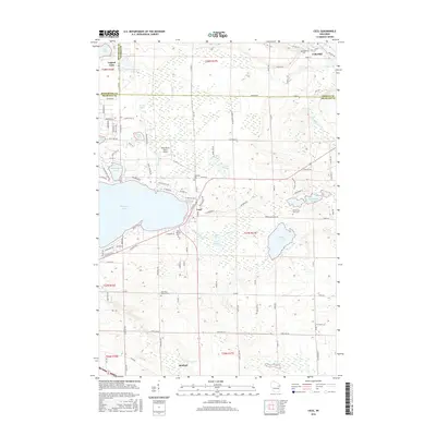
2016 Map of Cecil
USGS Topo · Published 2016About this map
Cecil and Bonduel anchor this 2016 survey of eastern Shawano County, capturing the transition from the northeastern shores of Shawano Lake to the agricultural interior. The landscape is defined by its glacial legacy, featuring a high concentration of water bodies such as White Clay Lake, Washington Lake, and the Pensaukee Lakes. The Oconto River flows through the northern reaches near Underhill, while the W Br Shioc River winds through the southern landscape near Bonduel.
Find a feature on this map
123 named features on this map. Tap any name to fly to it.
Don’t see what you’re looking for? This feature index may not catch every label — zoom into the map to look around manually.
Map Details
Editions of this 2016 Cecil Map
This is the sole edition of this map. No revisions or reprints were ever made.
Other maps of this area

1954 · Shawano
USGS Topo · 1:48,000

1955 · Embarrass
USGS Topo · 1:48,000

1955 · Seymour
USGS Topo · 1:62,500

1955 · Green Bay
USGS Topo · 1:250,000

1956 · Gillett
USGS Topo · 1:62,500

1964 · Shawano
USGS Topo · 1:62,500

1969 · Lunds
USGS Topo · 1:24,000

1974 · Cecil
USGS Topo · 1:24,000
1974 · Gillett
USGS Topo · 1:24,000
1974 · Berry Lake
USGS Topo · 1:24,000