2022 Map of Cecil
USGS Topo · Published 2022About this map
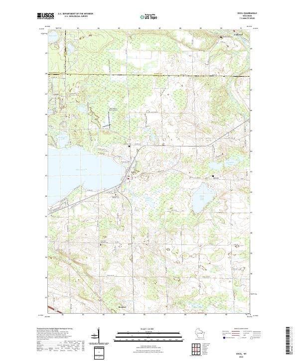
Shawano Lake and its smaller neighbor Washington Lake dominate the western portion of this Wisconsin landscape, where the village of Cecil serves as a lakeside hub. The region's settlement pattern is defined by a dense network of rural cemeteries and parish grounds, such as the Saint Paul Lutheran Cem and Saint Martin Catholic Cem, which reflect the community's ancestral ties. To the south, the village of Bonduel anchors the agricultural plains, while the north is defined by the winding course of the Oconto River near Underhill. Small glacial water bodies like White Clay Lake, Bahr Lake, and Korth Lake are scattered throughout the quadrangle, illustrating the complex hydrology of the area. A notable modern landmark is the Deer Haven Ranch Airport, situated north of the main lake system.
Find a feature on this map
118 named features on this map. Tap any name to fly to it.
Don’t see what you’re looking for? This feature index may not catch every label — zoom into the map to look around manually.
Map Details
Editions of this 2022 Cecil Map
This is the sole edition of this map. No revisions or reprints were ever made.