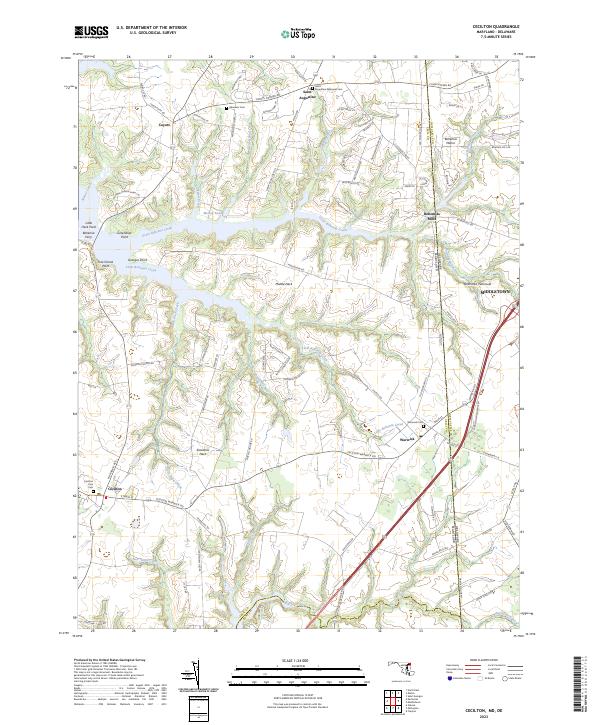
2023 Map of Cecilton
USGS Topo · Published 2023About this map
The Delmarva Peninsula landscape captured here is defined by the branching waterways of the Great Bohemia Creek and Little Bohemia Creek, which carve out prominent landforms like Middle Neck and Sassafras Neck. This 2023 survey illustrates a coastal plain geography where colonial-era settlement patterns persist alongside modern thoroughfares. The town of Cecilton anchors the southwest, while the historic enclave of Bohemia Manor sits at the northern boundary between Maryland and Delaware. The map serves as a vital record for genealogists, detailing several significant burial grounds including Cecilton Zion Cem, Warwick Cem, and the Saint Augustine Episcopal Cem near the settlement of Saint Augustine. These sites, along with names like Bohemias Mills, point to the region's long-standing agricultural and milling heritage along the tidal reaches of the Sassafras River.
Find a feature on this map
98 named features on this map. Tap any name to fly to it.
Don’t see what you’re looking for? This feature index may not catch every label — zoom into the map to look around manually.
Map Details
Editions of this 2023 Cecilton Map
This is the sole edition of this map. No revisions or reprints were ever made.
Other maps of this area

1898 · Elkton
USGS Topo · 1:62,500

1899 · Dover
USGS Topo · 1:125,000

1900 · Elkton
USGS Topo · 1:62,500

1900 · Cecilton
USGS Topo · 1:62,500

1904 · Wilmington
USGS Topo · 1:62,500

1906 · Dover
USGS Topo · 1:125,000

1906 · Wilmington
USGS Topo · 1:62,500

1917 · Elkton
USGS Topo · 1:62,500

1919 · Wilmington
USGS Topo · 1:62,500

1920 · Dover
USGS Topo · 1:125,000