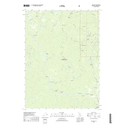
2018 Map of Cecilville
USGS Topo · Published 2018About this map
Cecilville sits at the confluence of several mountain drainages in this modern survey of the Klamath National Forest. The landscape is dominated by the steep canyons of the South Fork Salmon River and its numerous tributaries, including Matthews Cr and French Cr. Settlement is concentrated near the river, with the small community of Jennings Gulch located further north along the winding river corridor. High ridges and peaks such as Canyon Mtn and High Point provide significant vertical relief, while Limestone Bluffs stands out as a unique geological landmark above the water. A network of forest roads and historical routes, including Old Crawford, weaves through the drainages, reflecting a long history of timber access and mountain travel within the Salmon Mountains.
Find a feature on this map
50 named features on this map. Tap any name to fly to it.
Don’t see what you’re looking for? This feature index may not catch every label — zoom into the map to look around manually.
Map Details
Editions of this 2018 Cecilville Map
This is the sole edition of this map. No revisions or reprints were ever made.
Other maps of this area

1948 · Weed
USGS Topo · 1:250,000

1950 · Weed
USGS Topo · 1:250,000

1955 · Salmon Mtn
USGS Topo · 1:62,500

1955 · Cecilville
USGS Topo · 1:62,500

1955 · Sawyers Bar
USGS Topo · 1:62,500

1955 · Forks of Salmon
USGS Topo · 1:62,500

1958 · Weed
USGS Topo · 1:250,000

1963 · Weed
USGS Topo · 1:250,000
1977 · Tanners Peak
USGS Topo · 1:24,000
1978 · Cecilville
USGS Topo · 1:24,000