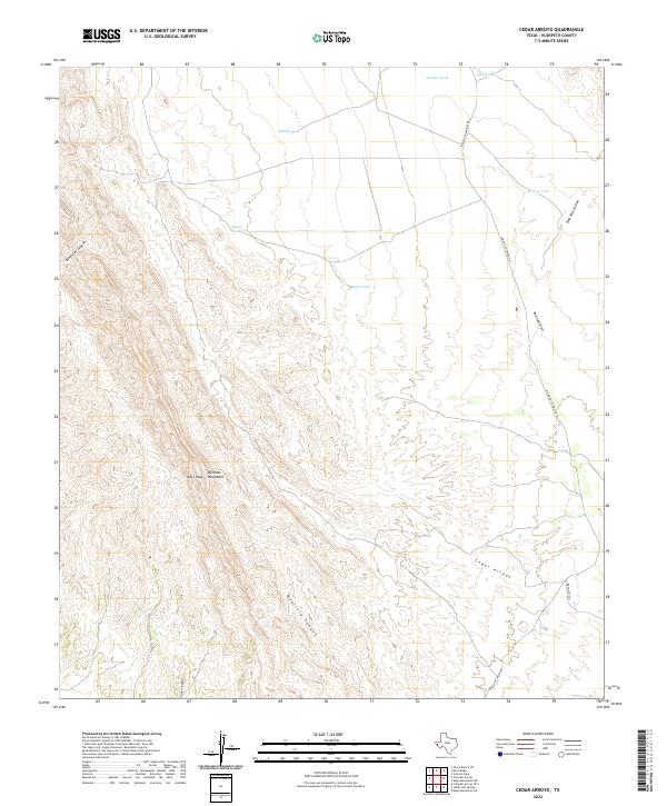
2022 Map of Cedar Arroyo
USGS Topo · Published 2022About this map
The Quitman Mountains dominate the western portion of this landscape, with Deer Peak serving as a primary high point overlooking a network of dry washes and canyons. The arid terrain is defined by its drainage patterns, most notably the winding course of Cedar Arroyo in the southeast and the seasonal Mayfield Canyon and Binocular Canyon to the west.
Find a feature on this map
16 named features on this map. Tap any name to fly to it.
Don’t see what you’re looking for? This feature index may not catch every label — zoom into the map to look around manually.
Map Details
Editions of this 2022 Cedar Arroyo Map
This is the sole edition of this map. No revisions or reprints were ever made.
Other maps of this area

1895 · Sierra Blanca
USGS Topo · 1:125,000

1897 · Eagle Mountain
USGS Topo · 1:125,000

1916 · Eagle Mountain
USGS Topo · 1:125,000

1954 · Van Horn
USGS Topo · 1:250,000

1958 · Van Horn
USGS Topo · 1:250,000

1959 · Marfa
USGS Topo · 1:250,000
1963 · Grayton Lake
USGS Topo · 1:24,000

1964 · Devil Ridge
USGS Topo · 1:24,000

1964 · Sierra Blanca SW
USGS Topo · 1:24,000

1965 · Marfa
USGS Topo · 1:250,000