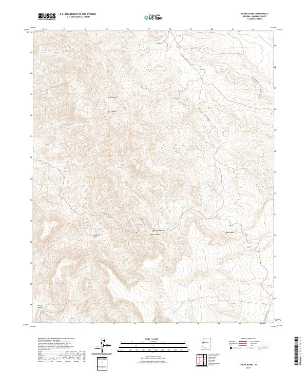
2021 Map of Cedar Basin
USGS Topo · Published 2021About this map
Cedar Basin and the striking Aquarius Cliffs define this high-elevation landscape in Mohave County, where deep canyons and ephemeral washes dictate the movement of water and travelers. The terrain is deeply incised by Hawk Canyon, Bull Canyon, and Boner Canyon, while Pearson Falls Wash and Tule Wash provide seasonal drainage across the northern stretches. This area reflects the arid reliance on scattered water sources, documented through numerous named springs such as Red Canyon Spring, Williams Spring, and Oak Spring.
Find a feature on this map
33 named features on this map. Tap any name to fly to it.
Don’t see what you’re looking for? This feature index may not catch every label — zoom into the map to look around manually.
Map Details
Editions of this 2021 Cedar Basin Map
This is the sole edition of this map. No revisions or reprints were ever made.
Other maps of this area

1923 · Signal
USGS Topo · 1:250,000

1942 · Signal
USGS Topo · 1:250,000

1950 · Prescott
USGS Topo · 1:250,000

1954 · Prescott
USGS Topo · 1:250,000

1958 · Prescott
USGS Topo · 1:250,000

1959 · Prescott
USGS Topo · 1:250,000

1960 · Prescott
USGS Topo · 1:250,000

1965 · Prescott
USGS Topo · 1:250,000
1967 · Tom Brown Canyon
USGS Topo · 1:24,000
1967 · Tule Wash
USGS Topo · 1:24,000