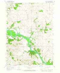
1965 Map of Cedar Bluff
USGS Topo · Published 1967About this map
The Cedar River carves a winding path through this mid-1960s landscape, serving as a geographic anchor for the townships of Cass, Gower, and Pioneer. The village of Cedar Bluff sits near the riverbanks, surrounded by an agricultural network defined by early community landmarks. Local history is etched into the terrain through sites like Coon Creek Ch and St Bridget Ch, alongside several family and community burial grounds including Evergreen Cem, Mason Cem, and Shawver Cem. Evidence of past infrastructure is visible in the Old RR Grade south of the river, while the local economy is represented by various Quarry and Quarries operations. Numerous waterways such as Clear Creek, Rock Run Creek, and Baldwin Creek feed the larger river system, illustrating the drainage patterns of this rural Iowa region.
Find a feature on this map
24 named features on this map. Tap any name to fly to it.
Don’t see what you’re looking for? This feature index may not catch every label — zoom into the map to look around manually.
Map Details
Editions of this 1965 Cedar Bluff Map
This is the sole edition of this map. No revisions or reprints were ever made.
Other maps of this area

1889 · Tipton
USGS Topo · 1:62,500

1890 · Tipton
USGS Topo · 1:62,500

1891 · Mechanicsville
USGS Topo · 1:62,500

1891 · Wilton Junction
USGS Topo · 1:62,500

1894 · Mechanicsville
USGS Topo · 1:62,500

1894 · West Liberty
USGS Topo · 1:62,500

1901 · Stanwood
USGS Topo · 1:125,000

1958 · Davenport
USGS Topo · 1:250,000

1961 · Davenport
USGS Topo · 1:250,000

1962 · Davenport
USGS Topo · 1:250,000