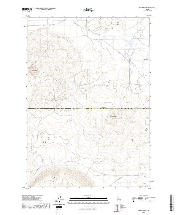
2023 Map of Cedar Butte
USGS Topo · Published 2023About this map
Cedar Butte and Camas Butte dominate the landscape of this high desert region along the border of Clark and Jefferson Counties. The topography reflects the volcanic character of the area, with Table Butte rising to the south of the Rock Lakes. This eastern Idaho terrain is defined by its wide-open expanses and sparse water sources, primarily represented by the seasonal drainage of Cottonwood Creek and Beaver Creek. Human impact is visible through a network of remote corridors including Beaver Creek Rd and the Snake River Plain Rd, which follow the natural contours of the basin. The presence of Dutch Flat in the northeast corner suggests the specific local geography used by early settlers and ranchers in this part of the Snake River Plain.
Find a feature on this map
17 named features on this map. Tap any name to fly to it.
Don’t see what you’re looking for? This feature index may not catch every label — zoom into the map to look around manually.
Map Details
Editions of this 2023 Cedar Butte Map
This is the sole edition of this map. No revisions or reprints were ever made.
Other maps of this area

1955 · Dubois
USGS Topo · 1:250,000

1955 · Idaho Falls
USGS Topo · 1:250,000

1958 · Dubois
USGS Topo · 1:250,000

1958 · Idaho Falls
USGS Topo · 1:250,000

1964 · Dubois NW
USGS Topo · 1:24,000

1964 · Lone Butte
USGS Topo · 1:24,000

1964 · Small
USGS Topo · 1:24,000

1964 · Cedar Butte SW
USGS Topo · 1:24,000
1964 · Hamer
USGS Topo · 1:24,000

1964 · Mud Lake NW
USGS Topo · 1:24,000