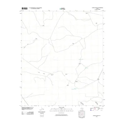
2010 Map of Cedar Canyon
USGS Topo · Published 2010About this map
Cedar Canyon and its surrounding drainage systems define this section of the Edwards Plateau in Crockett County during the early 21st century. The landscape is characterized by a high-desert water infrastructure, where numerous named windmills and tanks supported ranching operations across the arid terrain. Key landmarks like Cedar Hill and Round Mountain provide topographic relief above the complex network of dry washes, including Javelina Draw and the headwaters of West Prong Simpson Canyon. The distribution of features such as Carter Windmill, Oil Well Windmill, and Red Tower Windmill illustrates the persistent reliance on groundwater for land use in this part of West Texas. Smaller catchments like Telephone Tank and Rock Tank are scattered throughout the quadrangle, marking the scarce locations of surface water management in a region defined by its rugged limestone geology.
Find a feature on this map
19 named features on this map. Tap any name to fly to it.
Don’t see what you’re looking for? This feature index may not catch every label — zoom into the map to look around manually.
Map Details
Editions of this 2010 Cedar Canyon Map
This is the sole edition of this map. No revisions or reprints were ever made.
Other maps of this area

1928 · Crane
USGS Topo · 1:125,000

1928 · Rankin
USGS Topo · 1:125,000

1929 · Sheffield
USGS Topo · 1:125,000

1929 · Independence Draw Quadrangle
USGS Topo · 1:125,000

1954 · Pecos
USGS Topo · 1:250,000

1954 · Fort Stockton
USGS Topo · 1:250,000

1954 · Sonora
USGS Topo · 1:250,000

1954 · San Angelo
USGS Topo · 1:250,000

1957 · Pecos
USGS Topo · 1:250,000

1958 · Sonora
USGS Topo · 1:250,000