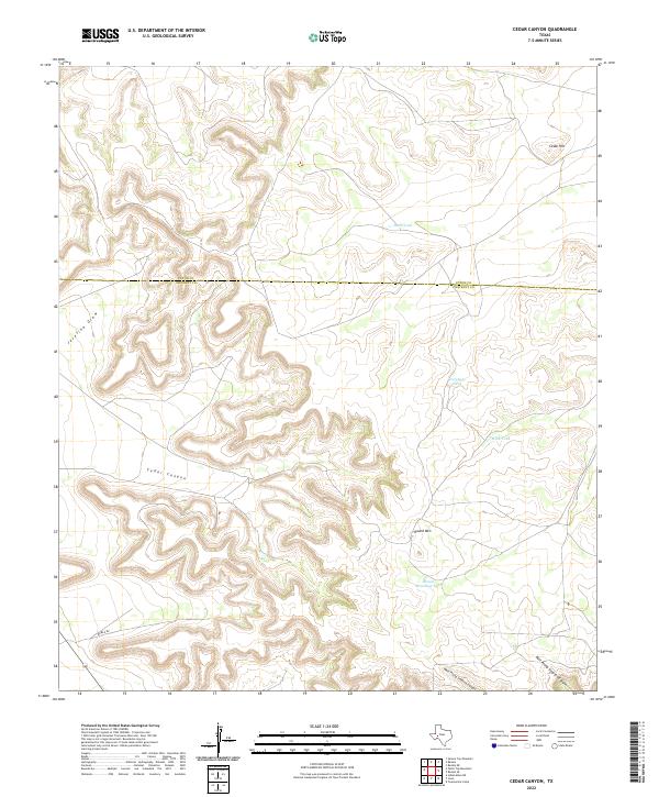
2022 Map of Cedar Canyon
USGS Topo · Published 2022About this map
The boundary between Upton and Crockett Counties cuts across this high-desert landscape, dominated by intricate drainage systems and ranching infrastructure. Steep relief defines the area, most notably where Cedar Canyon carves through the central terrain below Cedar Hill. The land use is characterized by numerous catchment basins essential for livestock, such as Jacks Tank, Telephone Tank, and Rock Tank, which are scattered among the mesas and draws. To the southwest, Javelina Draw provides a significant drainage route, while the southeast is marked by the branching forks of West Prong Simpson Canyon and East Prong Simpson Canyon. Round Mtn serves as a prominent local landmark near Round Mountain Tank, illustrating how topographical features and water resources dictate the spatial layout of this remote portion of the Trans-Pecos region.
Find a feature on this map
12 named features on this map. Tap any name to fly to it.
Don’t see what you’re looking for? This feature index may not catch every label — zoom into the map to look around manually.
Map Details
Editions of this 2022 Cedar Canyon Map
This is the sole edition of this map. No revisions or reprints were ever made.
Other maps of this area

1928 · Crane
USGS Topo · 1:125,000

1928 · Rankin
USGS Topo · 1:125,000

1929 · Sheffield
USGS Topo · 1:125,000

1929 · Independence Draw Quadrangle
USGS Topo · 1:125,000

1954 · Pecos
USGS Topo · 1:250,000

1954 · Fort Stockton
USGS Topo · 1:250,000

1954 · Sonora
USGS Topo · 1:250,000

1954 · San Angelo
USGS Topo · 1:250,000

1957 · Pecos
USGS Topo · 1:250,000

1958 · Sonora
USGS Topo · 1:250,000