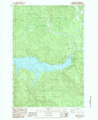
1983 Map of Cedar Flats
USGS Topo · Published 1984About this map
The Swift Reservoir and the Lewis River dominate this early 1980s topographic survey of the Gifford Pinchot National Forest. This era in Skamania County shows a landscape shaped by water management and forest service operations, centered around the settlement of Northwoods. The map documents the recreational and industrial infrastructure of the time, including the Swift Forest Campground, a Trailer Park, and the Pine Creek Work Center. Notable terrain features such as Eagle Cliffs and McClellan Mountain rise above the drainage basins of the Muddy River and Paradise Valley Creek. The presence of several Borrow Pits and a Gravel Pit suggests ongoing maintenance of the forest road system near the National Forest Boundary.
Find a feature on this map
24 named features on this map. Tap any name to fly to it.
Don’t see what you’re looking for? This feature index may not catch every label — zoom into the map to look around manually.
Map Details
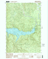
Editions of this 1983 Cedar Flats Map
2 editions found
Other maps of this area

1919 · Mount St Helens
USGS Topo · 1:125,000

1926 · Steamboat Mtn
USGS Topo · 1:125,000

1926 · Hood River
USGS Topo · 1:125,000

1929 · Hood River
USGS Topo · 1:125,000

1931 · Steamboat Mtn
USGS Topo · 1:125,000

1940 · Lookout Mtn
USGS Topo · 1:62,500

1948 · Vancouver
USGS Topo · 1:250,000

1950 · Vancouver
USGS Topo · 1:250,000

1950 · Vancouver
USGS Topo · 1:250,000

1950 · Yakima
USGS Topo · 1:250,000