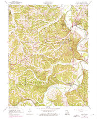
1954 Map of Cedar Hill
USGS Topo · Published 1966About this map
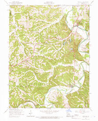
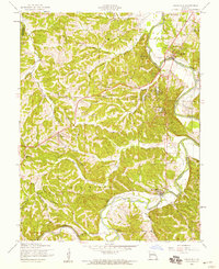
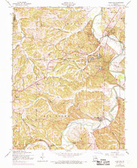
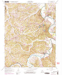
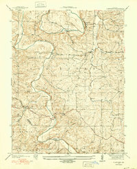
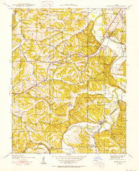
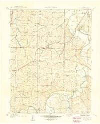
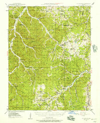
The Big River carves a winding path through this Jefferson County landscape, anchoring settlements like Cedar Hill and Morse Mill. At mid-century, the area remained largely rural, defined by a network of local roads such as Ware Road and Skullbone ROAD. Smaller communities like Dittmer and Oermann serve as inland hubs, supported by institutional landmarks including St Martins Ch and Maple Grove Sch. The topography is notably dissected by numerous tributaries, including Calvey Creek, Wine Creek, and Dutch Creek, which feed into the primary river valley.
Find a feature on this map
33 named features on this map. Tap any name to fly to it.
Don’t see what you’re looking for? This feature index may not catch every label — zoom into the map to look around manually.
Map Details
Editions of this 1954 Cedar Hill Map
5 editions found
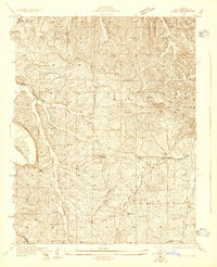
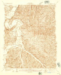
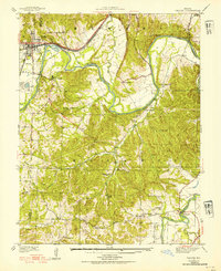
Other maps of this area

1901 · De Soto
USGS Topo · 1:125,000

1930 · De Soto NE
USGS Topo · 1:24,000
1930 · Pacific SE
USGS Topo · 1:24,000
1931 · Pacific NE
USGS Topo · 1:24,000
1937 · Pacific
USGS Topo · 1:24,000
1937 · Fletcher
USGS Topo · 1:24,000
1938 · Cedar Hill
USGS Topo · 1:24,000

1938 · Fletcher
USGS Topo · 1:24,000
1940 · Cedar Hill
USGS Topo · 1:24,000
1946 · Richwoods
USGS Topo · 1:62,500
Featured Places
- Cedar Hill Lakes, Meramec Township
- Cedar Hill, Meramec Township
- Dittmer, Meramec Township
- Central Township, MO
- Oermann, Big River Township