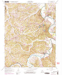
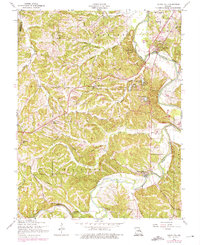
1954 Map of Cedar Hill
USGS Topo · Published 1975About this map
Big River winds through the heart of this landscape, anchoring a network of small mid-century communities and rural landmarks across the Jefferson and Franklin County line. This survey, updated with 1970s revisions, illustrates the established settlement patterns of Morse Mill and Cedar Hill, where the river's path dictates the local infrastructure. Local history is preserved through the locations of the Grubville Sch, St Martins Ch, and Bethlehem Ch, alongside distinctive properties like the 101 Ranch. The map captures the development of water resources, from the natural course of Calvey Creek and Dutch Creek to the creation of Cedar Hill Lakes and Lake Adelle. These features collectively reveal the evolution of a Missouri river valley from traditional mill-site settlements like Morse Mill toward a more modern, recreation-influenced topography.
Find a feature on this map
26 named features on this map. Tap any name to fly to it.
Don’t see what you’re looking for? This feature index may not catch every label — zoom into the map to look around manually.
Map Details
Editions of this 1954 Cedar Hill Map
5 editions found
Other maps of this area

1901 · De Soto
USGS Topo · 1:125,000

1930 · De Soto NE
USGS Topo · 1:24,000

1930 · Pacific SE
USGS Topo · 1:24,000

1931 · Pacific NE
USGS Topo · 1:24,000

1937 · Pacific
USGS Topo · 1:24,000

1937 · Fletcher
USGS Topo · 1:24,000

1938 · Cedar Hill
USGS Topo · 1:24,000

1938 · Fletcher
USGS Topo · 1:24,000

1940 · Cedar Hill
USGS Topo · 1:24,000

1946 · Richwoods
USGS Topo · 1:62,500