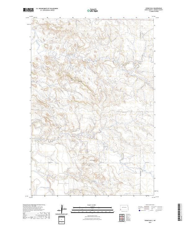
2024 Map of Cedar Hills
USGS Topo · Published 2024About this map
The Little Missouri River carves through the southwestern corner of this landscape, anchoring a complex drainage network that includes Coyote Creek, Spring Creek, and Bog Creek. This portion of Bowman County is defined by the elevation of the Cedar Hills and the prominent Sunset Butte, features that overlook the Plains Valley. The map reveals a remote, industrial infrastructure where rural section roads like 88th Ave W and 163rd Ave SW intersect with специализированный routes such as Oil Well Rd and Oilfield Rd. One of the more unique local designations, Oiled To The Dennis, suggests a specific history of road surfacing and local landmarks in this corner of North Dakota. The cartography provides a modern record of land divisions across several townships, documenting how energy extraction and traditional ranching terrain coexist in the 21st century.
Find a feature on this map
19 named features on this map. Tap any name to fly to it.
Don’t see what you’re looking for? This feature index may not catch every label — zoom into the map to look around manually.
Map Details
Editions of this 2024 Cedar Hills Map
This is the sole edition of this map. No revisions or reprints were ever made.
Other maps of this area

1953 · Dickinson
USGS Topo · 1:250,000

1957 · Dickinson
USGS Topo · 1:250,000

1973 · Kid Creek
USGS Topo · 1:24,000

1973 · Camel Butte
USGS Topo · 1:24,000

1973 · Cedar Hills
USGS Topo · 1:24,000
1973 · Mud Buttes
USGS Topo · 1:24,000

1973 · Rhame
USGS Topo · 1:24,000
1973 · Cedar Ridge
USGS Topo · 1:24,000

1979 · Ives
USGS Topo · 1:24,000

1980 · Marmarth
USGS Topo · 1:24,000