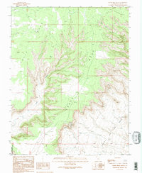
1989 Map of Cedar Mesa South
USGS Topo · Published 1995About this map
Cedar Mesa dominates this 1980s landscape, where the plateau drops sharply toward the Valley of the Gods. This transition is famously navigated by the Moki Dugway, a series of switchbacks carved into the cliff face. The map reveals the sparse human presence in this high-desert region, centered around the Lees Ranch and a remote Radio Facility. To the west, the boundaries of the Glen Canyon National Recreation Area encompass the deep incision of Johns Canyon. Local landmarks such as the Lady in the Bathtub rock formation highlight the unique erosion patterns that define the terrain. While the West Fork Lime Creek drains the northern reaches, the presence of a Drill Hole and scattered corrals indicate the region's limited history of grazing and resource exploration.
Find a feature on this map
14 named features on this map. Tap any name to fly to it.
Don’t see what you’re looking for? This feature index may not catch every label — zoom into the map to look around manually.
Map Details
Editions of this 1989 Cedar Mesa South Map
2 editions found
Other maps of this area

1886 · Henry Mountains
USGS Topo · 1:250,000

1886 · Abajo
USGS Topo · 1:250,000

1892 · Abajo
USGS Topo · 1:250,000

1892 · Henry Mountains
USGS Topo · 1:250,000

1893 · Abajo
USGS Topo · 1:250,000

1956 · Escalante
USGS Topo · 1:250,000

1956 · Cortez
USGS Topo · 1:250,000

1958 · Cortez
USGS Topo · 1:250,000

1959 · Cortez
USGS Topo · 1:250,000

1960 · Escalante
USGS Topo · 1:250,000