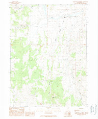
1989 Map of Cedar Mountain Draw
USGS Topo · Published 1989About this map
Emigrant Trail tracks cut across the northern terrain of this Elko County quadrangle, following the path of Goose Creek and Little Goose Creek. The landscape is defined by the high prominence of Cedar Mountain and the deep drainage of Cedar Mountain Draw, illustrating a remote section of Nevada where historic westward routes met the high desert plateau. Human activity is sparse but significant, centered on the Judd Ranch in the eastern flats and several Prospect sites to the southwest, indicating the area's dual history of ranching and mineral exploration. The water system is well-defined by intermittent drainages such as Horse Creek and Dry Gulch, which feed into the primary creek beds. This survey provides a clear view of the topography that greeted pioneers, with elevations clearly marked from the flats up to the heights of Record Bluff.
Find a feature on this map
14 named features on this map. Tap any name to fly to it.
Don’t see what you’re looking for? This feature index may not catch every label — zoom into the map to look around manually.
Map Details
Editions of this 1989 Cedar Mountain Draw Map
This is the sole edition of this map. No revisions or reprints were ever made.
Other maps of this area

1955 · Wells
USGS Topo · 1:250,000

1958 · Wells
USGS Topo · 1:250,000

1961 · Wells
USGS Topo · 1:250,000

1961 · Delano Mountains
USGS Topo · 1:62,500

1961 · Gollaher Mountain
USGS Topo · 1:62,500

1961 · Goose Creek
USGS Topo · 1:62,500

1961 · Dairy Valley
USGS Topo · 1:62,500
1980 · Dry Canyon
USGS Topo · 1:24,000

1982 · Jackpot
USGS Topo · 1:100,000
1989 · Nile Spring
USGS Topo · 1:24,000