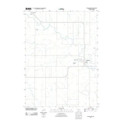
2011 Map of Cedar Rapids
USGS Topo · Published 2011About this map
The Cedar River meanders across the northern reaches of Boone County, anchoring the landscape between the settlements of Cedar Rapids and Primrose. In this part of Nebraska, the terrain is defined by the subtle drainage patterns of Silver Valley Creek and the North Branch Timber Creek, with Pilot Knob providing a rare named topographical marker in the rolling plains. The town of Cedar Rapids serves as a local hub, containing vital infrastructure like the Cedar Rapids Post Office and the Cedar Rapids Municipal Airport. Significant for genealogists, the map identifies three distinct burial grounds near the town: Saint Anthony Cemetery, Sunset Cemetery, and Sunrise Cemetery. These features, along with the smaller community of Primrose and its own Primrose Post Office to the northwest, document the rural civic structure of the region in the early 21st century.
Find a feature on this map
14 named features on this map. Tap any name to fly to it.
Don’t see what you’re looking for? This feature index may not catch every label — zoom into the map to look around manually.
Map Details
Editions of this 2011 Cedar Rapids Map
This is the sole edition of this map. No revisions or reprints were ever made.
Other maps of this area

1899 · St. Paul
USGS Topo · 1:125,000

1954 · Cedar Rapids
USGS Topo · 1:24,000

1954 · Spalding
USGS Topo · 1:24,000

1954 · Akron
USGS Topo · 1:24,000

1954 · Wolbach NE
USGS Topo · 1:24,000

1954 · Albion West
USGS Topo · 1:24,000

1954 · Belgrade
USGS Topo · 1:24,000

1954 · Belgrade NW
USGS Topo · 1:24,000

1954 · Cedar Rapids SE
USGS Topo · 1:24,000

1954 · Spalding SE
USGS Topo · 1:24,000