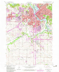
1967 Map of Cedar Rapids South
USGS Topo · Published 1983About this map
Cedar Rapids serves as the industrial and transport hub of Linn County, where the Cedar River flows past Municipal Island and the major rail corridors of the Chicago North Western. The map documents a significant era of post-war suburban and academic expansion, evidenced by the development of Lincolnway Village and the expansive grounds of Kirkwood Community College. Cultural and genealogical depth is found in the city's diverse burial grounds, including the St Johns Cemetery (Syrian), Bohemian Cemetery, and Muslim Cemetery. To the south, the Cedar Rapids Municipal Airport and the recreational Sac and Fox Trail follow the path of Prairie Creek, marking the transition from the dense urban grid of Clinton Township to the more open landscape of Fairfax and College townships.
Find a feature on this map
96 named features on this map. Tap any name to fly to it.
Don’t see what you’re looking for? This feature index may not catch every label — zoom into the map to look around manually.
Map Details
Editions of this 1967 Cedar Rapids South Map
3 editions found
Other maps of this area

1887 · Cedar Rapids
USGS Topo · 1:62,500

1888 · Shellsburg
USGS Topo · 1:62,500

1888 · Marion
USGS Topo · 1:62,500

1888 · Amana
USGS Topo · 1:62,500

1889 · Marion
USGS Topo · 1:62,500

1889 · Amana
USGS Topo · 1:62,500

1889 · Shellsburg
USGS Topo · 1:62,500

1891 · Cedar Rapids
USGS Topo · 1:62,500

1899 · Amana
USGS Topo · 1:62,500

1899 · Shellsburg
USGS Topo · 1:62,500
Featured Places
- Cedar Rapids, IA
- Summit, Cedar Rapids
- West Cedar Rapids, Cedar Rapids
- Worthington Acres, Cedar Rapids
- Linn County, IA