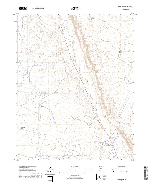
2021 Map of Cedar Ridge
USGS Topo · Published 2021About this map
Cedar Ridge serves as a central point in this high-desert landscape, situated where the terrain begins its dramatic ascent toward the Echo Cliffs. The 2021 survey reveals a complex drainage network essential to the region, including Tanner Wash, Gray Spot Wash, and Hamblin Wash, which carve through the land between major geological formations like the Kaibito Plateau and Limestone Ridge. Water management is evident through the inclusion of the Eagle Nest Reservoir and First Reservoir, reflecting the necessity of catchment in this arid environment. Transportation through the area is anchored by Indian Rte 6110, which provides access across Cornfield Valley and the southern reaches of Black Rock Ridge. The map captures the intersection of traditional land use and prominent physical landmarks such as the Cedar Tree Hills and South Red Hill.
Find a feature on this map
21 named features on this map. Tap any name to fly to it.
Don’t see what you’re looking for? This feature index may not catch every label — zoom into the map to look around manually.
Map Details
Editions of this 2021 Cedar Ridge Map
This is the sole edition of this map. No revisions or reprints were ever made.
Other maps of this area

1886 · Echo Cliffs
USGS Topo · 1:250,000

1891 · Echo Cliffs
USGS Topo · 1:250,000

1954 · Shinumo Altar NE
USGS Topo · 1:24,000

1954 · Shinumo Altar SE
USGS Topo · 1:24,000

1954 · Tanner Wash
USGS Topo · 1:62,500

1954 · Shinumo Altar
USGS Topo · 1:62,500

1956 · Marble Canyon
USGS Topo · 1:250,000
1957 · The Gap SW
USGS Topo · 1:24,000

1959 · Marble Canyon
USGS Topo · 1:250,000

1961 · Marble Canyon
USGS Topo · 1:250,000