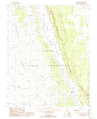
1988 Map of Cedar Ridge
USGS Topo · Published 1988About this map
The Navajo Indian Reservation landscape is defined by its dramatic geological formations and essential water management features in this 1980s survey. The Echo Cliffs run nearly the entire length of the eastern territory, creating a sharp divide between the high plateaus and Echo Valley. This arid environment necessitated a sophisticated network of Check Dams along Tanner Wash and its tributaries, revealing a pattern of land use focused on erosion control and water retention. Human presence is evidenced by scattered Corrals and managed water sources like Eagle Nest Reservoir and First Reservoir. The map illustrates a high-desert terrain where ridges such as Limestone Ridge, Cornfield Ridge, and Black Rock Ridge dictated movement and settlement patterns long before modern infrastructure reached this part of Coconino County.
Find a feature on this map
16 named features on this map. Tap any name to fly to it.
Don’t see what you’re looking for? This feature index may not catch every label — zoom into the map to look around manually.
Map Details
Editions of this 1988 Cedar Ridge Map
This is the sole edition of this map. No revisions or reprints were ever made.
Other maps of this area

1886 · Echo Cliffs
USGS Topo · 1:250,000

1891 · Echo Cliffs
USGS Topo · 1:250,000

1954 · Shinumo Altar NE
USGS Topo · 1:24,000

1954 · Shinumo Altar SE
USGS Topo · 1:24,000

1954 · Tanner Wash
USGS Topo · 1:62,500

1954 · Shinumo Altar
USGS Topo · 1:62,500

1956 · Marble Canyon
USGS Topo · 1:250,000
1957 · The Gap SW
USGS Topo · 1:24,000

1959 · Marble Canyon
USGS Topo · 1:250,000

1961 · Marble Canyon
USGS Topo · 1:250,000