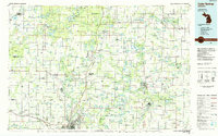
1985 Map of Cedar Springs
USGS Topo · Published 1985About this map
The Grand River and the northern expansion of Grand Rapids anchor this mid-1980s look at the West Michigan landscape. The map captures a transition from the urban reach of Walker and Comstock Park into the heavily forested and lake-strewn counties of Kent, Montcalm, and Newaygo. Key transit corridors, including U.S. 131 and the Chesapeake and Ohio RR, connect the city to outlying towns like Rockford and Cedar Springs.
Find a feature on this map
284 named features on this map. Tap any name to fly to it.
Don’t see what you’re looking for? This feature index may not catch every label — zoom into the map to look around manually.
Map Details
Editions of this 1985 Cedar Springs Map
This is the sole edition of this map. No revisions or reprints were ever made.
Other maps of this area

1914 · Grand Rapids
USGS Topo · 1:62,500

1916 · Mount Pleasant
USGS Topo · 1:62,500

1916 · Ionia
USGS Topo · 1:62,500

1918 · Cedar Springs
USGS Topo · 1:62,500

1918 · Ionia
USGS Topo · 1:62,500

1918 · Lowell
USGS Topo · 1:62,500

1919 · Mount Pleasant
USGS Topo · 1:62,500

1929 · Holland
USGS Topo · 1:62,500

1930 · Muskegon
USGS Topo · 1:62,500

1931 · Walkerville SE
USGS Topo · 1:31,680